Button CopyPathCircle CloseCircle Left ArrowArrow Down Icon GreyClosecirclecircleBurger
  • Advertising

Rng Rd 190, Rural Mackenzie County, AB, T0H 1Z0

MLS® # A2067866
Vacant Land For Sale In Rural Mackenzie County, Alberta
$85,000
Rng Rd 190, Rural Mackenzie County, AB
  • Advertising
ACTIVE
Rng Rd 190, Rural Mackenzie County, AB, T0H 1Z0
$85,000

Property Information:

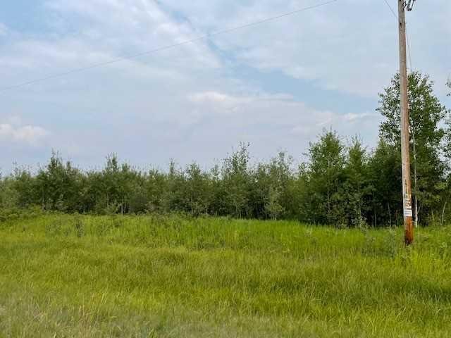
"Acreage Opportunity". This 9.93 acre parcel awaits your development. Located north east of High Level just off Highway 35 turning east down Heliport Road is where you will find this "GEM". Surrounded by tree's, for that seclusion lifestyle could be just what you are looking for. Backing onto the farmers field, you are sure to not have any rear neighbours. There is road access to this property.. So all you have to do is start designing that "DREAM HOME" in the country you have always wanted. . GST may apply.

Inclusions: NONE

Property Features:

  • Lot Size: 432550.00 Square Feet
  • Zoning: Agriculture

Courtesy of: M&M Real Estate

Data provided by: Grande Prairie & Area Association of REALTORS® 10106 102 St., Grande Prairie, Alberta T8V 2V7
All information displayed is believed to be accurate but is not guaranteed and should be independently verified. No warranties or representations are made of any kind. Copyright© 2021 All Rights Reserved

Location of Rng Rd 190, Rural Mackenzie County, AB, T0H 1Z0

Climate Risk Data

About Climate Risk: Properties are at increased risk of damage from extreme weather due to climate change.
ClimateCheck provides detailed climate risk data for properties now and up to 30 years into the future.

Projected Heat Risk: Significant

24 hot days expected in 2050

Projected Storm Risk: Significant

12 storms expected in 2050

Projected Heat Risk: Significant

24 hot days expected in 2050

28/100

Significant

ClimateCheck®

Current data

This property, Rng Rd 190 , experiences 7 hot days per year at around 28.1 degrees Celsius.

Projected data

Severe heat risk is expected to increase in this area. In 2050, it is projected that there will be 24 hot days at 30.9 degrees Celsius.

Projected Avg. Temperature

Past
28.1℃
2050
30.9℃

# Hot Days Per Year

Past
7
2050
24

About Heat Risk

Heat risk is the number of extreme heat days experienced each year looking at historical conditions (1980-2005) in your area and taking the 2% of the hottest days and projecting that into the future.

Projected Storm Risk: Significant

12 storms expected in 2050

23/100

Significant

ClimateCheck®

Current data

This property, Rng Rd 190 , experiences 10 significant 2-day storms per year, with about 154.9mm of precipitation per storm.

Projected data

Severe storms are expected to increase in this area. In 2050, it is projected that there will be 12 significant 2-day storms with 181.4mm of precipitation per year.

Precipitation Per Storm

Past
154.9mm
2050
181.4mm

48-Hour Storms Per Year

Past
10
2050
12

About Storm Risk

Storm risk is the number of high wind, wet or snowy events each year. Climate check looks at historical conditions (1980-2005) in your area, on the days with the top 1% of total precipitation in a year and projected to 2050.

Climate risk data is provided for informational purposes only on Royallepage.ca.
If you have questions or feedback about this data, get help at climatecheck.com.

Environmental Risks provided by ClimateCheck®

Royal LePage does not endorse nor guarantee this information. By providing this information, Royal LePage and its agents are not providing advice or guidance on climate risks. Royal LePage strongly recommends that consumers independently investigate the property’s climate risks to their own personal satisfaction.